INTRODUCTION TO MUSTANG
The former Himalayan Kingdom of Mustang in Nepal is the stuff of dreams and legends! Our Mustang Travel Guide gives you everything you need to know to discover the mysteries and wonders of Upper Mustang along the road to Lo Manthang and beyond.
Famously “off limits” for centuries, wild and barren, relentless high altitude, very sparsely populated with just a scattering of tiny villages, isolated Tibetan Buddhist monasteries, prehistoric sky caves, realm of the snow leopard, haunt of the fabled yeti and until very recently unconnected to the rest of the world by road!
Nowadays most visitors travel through Mustang and to Lo Manthang by road – see the “How to get there” section further below for more.
To be correct Mustang was actually known as the Kingdom of Lo and became known as Upper Mustang when it ceased to be an independent kingdom. There is also Lower Mustang, although this part of Mustang is not a restricted area like Upper Mustang. The village of Kagbeni is where Upper Mustang begins.

It’s little wonder that stories of this isolated land beyond the Himalayas has captured the romantic imagination of intrepid explorers. Tales of this hidden, mysterious Kingdom and stories of an isolated “walled city” at Lo Manthang at a height of around 12,500 feet (3810m) that was ruled by a king in a royal palace and a medieval Tibetan Buddhist civilisation came only from yak caravans that dared to cross this inhospitable landscape making a perilous journey to India whilst laden with salt from the Tibetan Plateau helped fuel the “myths of Mustang”.
Like all tales and stories as they get passed on they get embellished along the way, which only made the allure of Mustang even greater. Add to the fact that Mustang was closed to foreigners, well…that only heightened the fascination with Mustang even more.
And of course there’s the delicious sounding name itself…”Mustang”…it’s associated with a horse and a muscle car...wild and untamed!

In 1795 Mustang was annexed by the Kingdom of Nepal, so ceased to be an independent kingdom. Then in 2008 Nepal became a republic, so along with that Mustang also was no longer a kingdom.
The last official and then unofficial king of Mustang died in 2016.
The first “official” westerner allowed into Mustang was only in 1952 and probably the first westerner to actually stay in Lo Manthang wasn’t until 1964 and it’s as recent as 1992 that tourists have been allowed to visit Mustang, but only with a special permit, which you still need to visit Upper Mustang today to venture beyond Kagbeni (see special permit section further below).

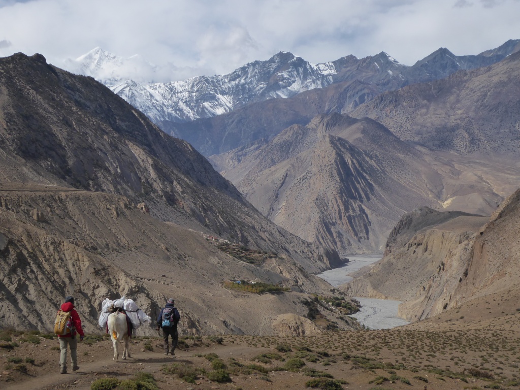
But, even in 1992 there were no roads in Mustang. So up until the completion of a road to Lo Manthang in 2016 the only way to explore Mustang was on foot i.e. trekking. Relentless high altitude, a hostile landscape and a harsh climate meant that trekking for days on end over high passes to reach Lo Manthang was quite the challenge and thus deterred all but the hardy. Accommodation along the way was pretty meagre to say the least.
Put all this together and it should be no surprise to learn that Mustang remains one of the most culturally preserved regions in the entire world.
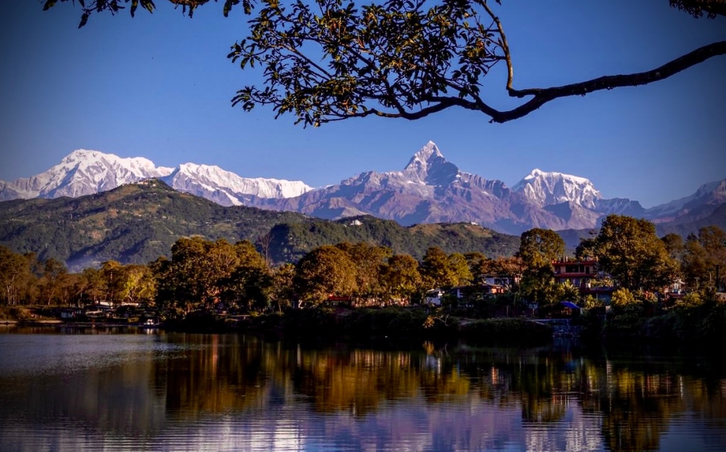
Mustang is the only part of Nepal that is situated on “the other side” of the Himalaya on the Tibetan Plateau. As such, the monsoon does not reach Mustang. In fact it rarely rains in Mustang, so the landscape is mostly arid and barren. At its lowest point Mustang is still some 10,000 feet (around 3,000m) above sea level.
The culture of Mustang is distinctly Tibetan in all aspects, whereas much of Nepal (not all) is mostly Hindu.
Mustang is a very unique and special part of Nepal and very different both geographically and culturally to the rest of Nepal.
Also see our detailed NEPAL TRAVEL GUIDE
TRAVEL GUIDE TO MUSTANG
Contents
- Places to visit in Mustang
- The landscape and wildlife of Mustang
- Tibetan Buddhist Monasteries of Mustang
- Sky caves of Mustang
- People and Culture of Mustang
- Trekking in Upper Mustang
- Accommodation in Mustang
- How to get to Mustang
- When to go to Mustang
- The Upper Mustang Restricted Area Permit
PLACES TO VISIT IN MUSTANG
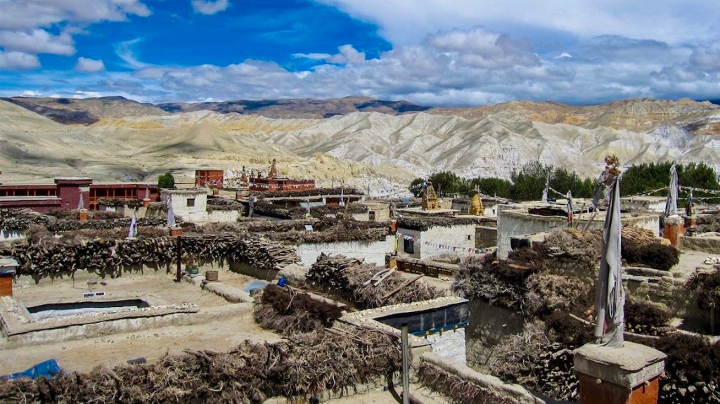
The population of the entire region of Mustang is only around 14,000 and largely concentrated in the numerous small, traditional villages scattered along the main Kali Gandaki Valley and side valleys, plus the area around Lo Manthang. Even the “walled city” of Lo Manthang, the capital of Mustang has a population of less than a thousand inhabitants.
A combination of high altitude and an arid and often bitterly cold climate, with very limited water available to sustain human life and what can actually be cultivated in Mustang makes life very tough up here.

Yet it is amongst these tiny almost medieval looking villages of whitewashed mud brick and stone homes, with their flat topped timber roofs and narrow cobbled alleyways, along with colourful Tibetan Buddhist monuments such as Chortens and mani (prayer) walls that the “heart and soul” of Mustang can be found.
Typical villages of Mustang include:
Lo Manthang
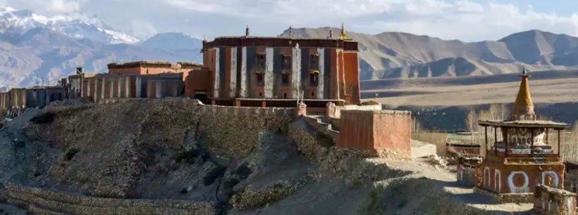
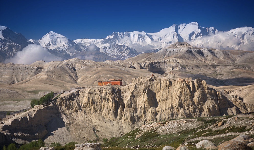
Getting to the fabled “walled city” of Lo Manthang is pretty much the objective for everyone visiting Mustang. This, the capital of the former Kingdom of Mustang is indeed surrounded by a wall, but it’s a small and rather remote village and not a city. There are around just 200 homes in Lo Manthang itself and approximately 880 inhabitants, although there are around 2,400 people in what is known as the Lo Manthang Rural Municipality, which includes outlying settlements in the Lo Manthang valley area.
Lo Manthang dates back as far as 1380 and was founded by the warrior Ame Pal. Around this time the walls surrounding the “city” were built and can still be seen. In fact Lo Manthang has changed very little in appearance since then.
Lo Manthang lies at an altitude of 12,500 feet (3810m) above sea level. The former royal palace still remains as well as four major temples: Jampa Lhakhang or Jampa Gompa, the oldest, built in the early 15th century and also known as the “God house”; Thubchen Gompa, a huge, red assembly hall and Gompa built in the late 15th century and located just southwest of Jampa Gompa; Chodey Gompa and the Choprang Gompa.
A strategic location gave Lo Manthang and the Kingdom of Lo control over the trade between Tibet and India, with the Kali Gandaki being one of the lower valley crossings through the Himalayas.
Kagbeni
For centuries, the Tibetan-influenced village of Kagbeni in Mustang has been a ‘passing through’ place. Lying on the once major trading route between Tibet and India caravans have been stopping off at Kagbeni after crossing the arid Tibetan plateau or before descending the Kali Gandaki Valley. It is also the “gateway” to Upper Mustang as here is far as you can venture without a “Mustang Permit”. Consequently part (most) of Kagbeni is in Lower Mustang although beyond the police check point it’s Upper Mustang.

Trekkers on the Annapurna Circuit often take a welcome break at Kagbeni too.
There are spectacular views of the Nilgiri peaks, as well as the wondrous sight of huge Himalayan vultures and lammergeier soaring on the early morning thermals.
Take a stroll onto the stony Kali Gandaki River bed and you might just find fossils of long since extinct sea creatures as you’re standing on what was once the bottom of the Tethys Ocean, even if it is now at 9,500 feet (2900m) above sea level today!
Chhukksang
The village of Chhukksang at almost 10,000 feet up (3020m) is one of the first traditional typically Mustang style villages within Upper Mustang that is encountered on the journey to Lo Manthang once beyond Kagbeni.
With the high altitude of Upper Mustang usually becoming noticeable around this point, this particular village makes for an ideal place to halt and spend a a couple of nights to allow the body to acclimatise and adjust to the altitude.

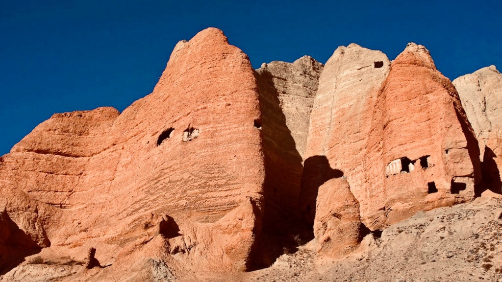
The location is definitely spectacular as Chhukksang is surrounded by huge, vertical cliffs coloured red, orange, grey and almost silver. Amongst some of these dramatic cliffs are mysterious, seemingly inaccessible sky caves (see the sky caves section further down).
The village lies where the Narsing Khola River Valley meets the main Kali Gandaki and just a short drive up the Narsing Khola leads to the by and large undisturbed settlement of Tangbe, where there’s a small Himalayan salt mine close by.
On the opposite side of the Kali Gandaki the rarely visited Gumbakang Gompa can be reached on foot as a short 4 hour return walk.
Ghyakar
Tiny Ghyakar at 11,700 feet (3560m) is where you might discover the “Mustang that was”.
It’s really more a settlement of just a few homes than a village.
As the road to Lo Manthang doesn’t pass through Ghyakar, few visitors come here and so Ghyakar largely remains unchanged by time and progress. Although it’s a relatively short detour from the road, in some ways visiting Ghyakar is akin to travelling back in time.

In fact there are quite a few tiny settlements similar to Ghyakar to be found in Upper Mustang up various side valleys leading from the Kali Gandaki or from the main road.
Ghyakar itself is home to a handful of arable farmers and sheep herders with a distinctly medieval, off the beaten track feel to it.
Fascinating to explore, there are also great views of the Annapurna range and Tilicho Peak too. Keep an eye out for the wild blue sheep that frequent the area. The blue sheep being a favourite prey of the very rare and seldom seen snow leopard.
Polyandry was a practice until recent times in Ghyakar. Maybe it still is?
Yara
Again away from the main road and only recently reachable via a rough dirt road, the village of Yara lies on the eastern side of the Kali Gandaki and is also rarely visited as a result.
Most people that have historically passed through Yara being trader caravans and then hardy trekkers making their way back from Lo Manthang following a more challenging route.
There’s a real sensation of being in a mountain desert at Yara, although this timeless, traditional Mustang village is ingeniously irrigated, so the sculpted, terraced fields afford some greenery to this otherwise “martian” landscape. Consequently, Yara remains a bit of a hidden gem with a unique blend of culture, history and beauty.

The houses in Yara are built with mud and stones and the roofs are made of wooden planks. The village has narrow lanes and alleys; houses are built close to each other. The architectural style of the village is distinct and reflects the rich heritage of Yara in Upper Mustang.
The people of Yara are primarily engaged in agriculture and animal husbandry. The village is known for growing barley, wheat and buckwheat. Some locals also rear sheep, goats, and yaks. The people of Yara are friendly and hospitable, and they are renowned for their traditional lifestyle.
The villagers of Yara claim that their ancestry can be traced back in time to those that lived in the sky caves of Upper Mustang.
Charang (Tsarang)
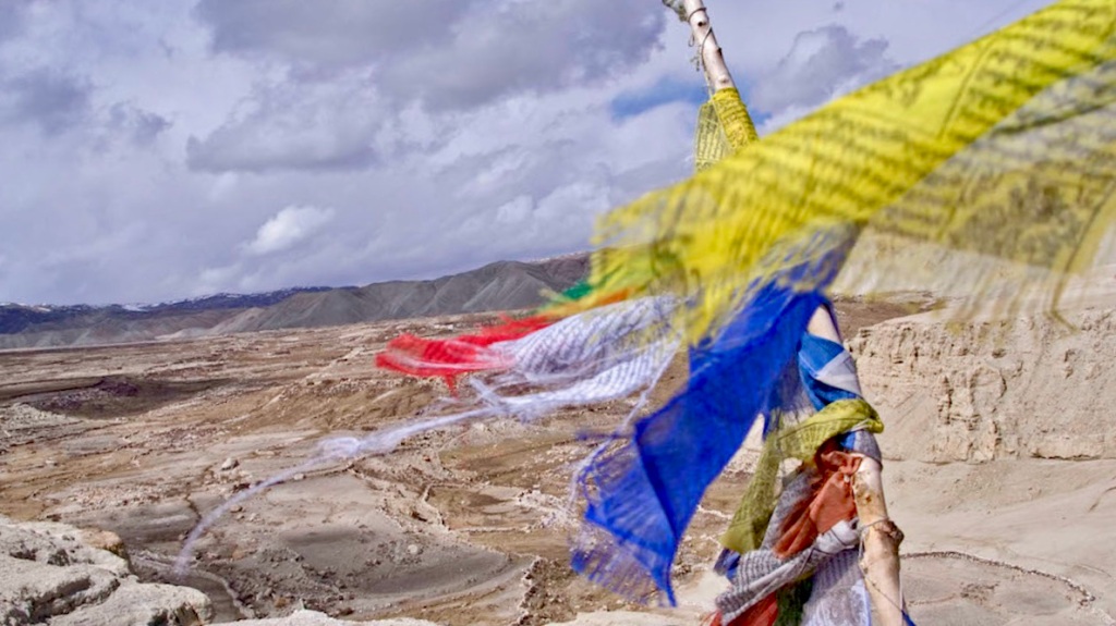
Brightly coloured prayer flags waft on the cool breeze. Tibetan Buddhist Chortens and Mani (Prayer) Walls surround the village of typically “Mustang style” homes, which form a maze of narrow stone flagged alleyways and whitewashed mud and stone houses with flat timber-topped roofs that blend so perfectly with the surrounding landscape.
Charang is probably the second largest village in Mustang, but with only around 130 homes that’s hardly large. There’s an ancient monastery and a former palace of the Raja of Mustang, numerous chortens, stupas, and other ancient Tibetan Buddhist relics to discover too.

The ruin of the former palace is strategically located astride a hill. It’s a steep, short hike up to the palace and although it is now dilapidated, there are great views from here and the small chapel and armoury (now a museum) are open to the public. On display are the blackened, macabre hands that are said to belong to the Master Builder of the palace.
As a mark of respect they were cut off after his death and placed there in his honour. Another story says that they were cut off while he was still alive so he would never build another.
With Lo Manthang being just a short drive away, Charang is nothing like as busy even though it’s on the main road and is all the better for it too.
Charang is an ideal base for a couple of nights to explore the hidden valleys and villages of both the western and eastern sides of the Kali Gandaki Valley.
Lo Manthang Valley area
Beyond Lo Manthang itself there are several small villages that can be reached by farm tracks and jeep tracks. Just a 30 minute drive from Lo Manthang you can reach Nyamdo and feel like you’ve travelled from the 21st Century back to a medieval farming community.
Close by there’s also Namgyal where the Gelup Sect Monastery of Victory can be found. Other small settlements in the area include Niphu, which also has a small monastery and Dhuk, which affords outstanding views back across Mustang to the Annapurna range.
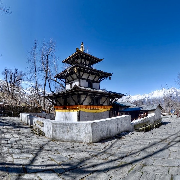
Muktinath
Although not in Upper Mustang, many visitors to Mustang take advantage of the fact that there is a decent metalled road up to Muktinath from Kagbeni as a short detour from the main road to Lo Manthang from the Kali Gandaki Valley floor.
Muktinath is of course famous for two reasons. For western tourists trekking the Annapurna Circuit, Muktinath was a very welcome sight as it’s the first village and respite after the brutal crossing of the Thorung La, which at 17,700 feet (5416m) is one of the highest trekking route passes in the world (5416m). As if the climb up to the Thorung La itself isn’t hard enough, the descent from the pass down to Muktinath at 12,470 feet (3800m) is long and at times steep.
But, more so Muktinath and its location in the high ramparts of the Himalaya is an important place of pilgrimage to both Hindus and Buddhists alike
Many pilgrims come to Muktinath to offer prayers and perform rituals and the Vishnu temple of Shree Muktinath is considered one of the most sacred shrines, as well as being one of the world’s highest too. There are also 108 water springs here, which carry great religious significance.
The landscape and wildlife of Mustang
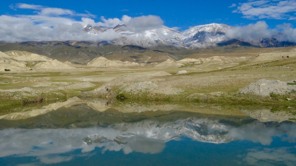
Simply put the landscape of Mustang is a high, mountainous desert. Hostile and truly wild. Except for the few inhabitants that live in Upper Mustang in the Kali Gandaki Valley and Lo Manthang areas, the remainder of this sizeable region is almost devoid of permanent human habitation.

It very rarely rains in Mustang and with snow melt being the primary contributor to the few (often dry) rivers in Mustang, not surprisingly water is scarce.
On top of that at these high altitudes winter in particular can be bitter and is made even harsher by the cold winds that emanate from Central Asia.
Thus most of Mustang is complete and mostly desolate wilderness.
However, this wild and hostile landscape is also dramatic. There is great beauty and colour too.

To the far north west in a remote, distant corner of Mustang on the border with Tibet lie the high snow capped ranges of the Mustang Himal and Chungen Changma Himal, which rise to heights over 20,000 feet (6,000+m).
These mountains are so inaccessible they are rarely explored.
Below the high peaks are the hills of the Mustang “Badlands”. In the valleys are precipitous cliff faces and the strong winds that blight Mustang have eroded these cliffs into weirdly sculpted shapes.
The pigmented colourations of the landscape-ochre, brown, grey, red, yellow and sometimes silver have a mesmerising “other worldly” appearance. You could be forgiven for thinking you’re on Mars up here in Mustang.
The colour green is a rarity in the Mustang wilderness. But, particularly during the summer months patches of grassland appear and occasionally you might come across juniper and other scrub vegetation.
Although rare and seldom seen, wildlife can and does survive up here. Apex predators include the snow leopard, Tibetan wolf, Pallas’ Cat and the Himalayan Lynx. The Himalayan bear (perhaps perpetuating the yeti myth) is also known to roam the Mustang hills.

Of course if there are predators, then there has to be prey. The blue sheep (a snow leopard favourite) exists in small herds, along with other species such as the Himalayan marmot, hare, pika, musk deer, Tibetan gazelle and various small rodent species.
The kiang (a wild ass) is sometimes encountered in remote valleys away from areas where it has to compete with domesticated livestock.

Huge Griffon vultures soar effortlessly on rising thermals. Lammergeier and Golden Eagle too.
Over 200 species of birds have been recorded in Upper Mustang.
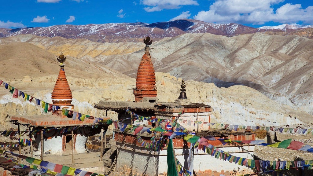
Tibetan Buddhist Monasteries of Mustang
The Tibetan Buddhist faith is an inseparable part of Mustang. Tibetan Buddhist monasteries are known locally as Gompa’s.
Indeed there are quite a few Gompa’s throughout Mustang.
Some of these monasteries are so remote and isolated it would take days of wild and tough trekking to reach them, although they are more like “cave temples” and used for meditation.
But, some can be encountered in the various villages along the main road to Lo Manthang, or up hidden side valleys and reachable by 4WD vehicle.
In fact within the walls of Lo Manthang itself there are four Tibetan Buddhist monasteries.
Jampa Lhakhang or Jampa Gompa was established by king Angon Sangpo and dates back to the 15th century.
Thubchen Gompa, a huge, red assembly hall and Gompa built is located just southwest of Jampa Gompa and was built by Tashi Gon, the third king of Lo.

Chodey Gompa is the largest Sakya Pa sect monastery and home to the highest ranking lamas. It has a small museum where Bon Po scriptures are contained. The Bon Po faith pre-dates Tibetan Buddhism.
Chopra Gompa is often referred to as the “new” Gompa.
In Charang the Gompa is around 500 years old. The inner walls of the main temple are painted with murals depicting the deities of the Medicine Buddha mandala. The Ani Gompa to the rear looks like it’s falling over a cliff and is in fact a “nunnery”.

A jeep road from Charang up a side valley now leads to the small settlement of Lo Gekar. Above which is located the ancient, remote monastery of Ghar Gompa, which lies at an altitude of 3950m. Dating back some 1200 years, Ghar Gompa is one of the oldest and most important monasteries in Mustang. The interior of the monastery greets the visitor with tiles of Buddha Sakyamuni and Bodhisattvas.

The Gonkhang is situated before the main room, the different protectors are shown only once a year during a special festival. Dozens of butter lamps illuminate the main room, making the many statues even more beautiful. The main statue is Padmasambhava, to each side are his two Yoginis, Yeshe Tshogyal and Mandarava. A statue of a Green Tara may also be found in a smaller room.
Also remote, but now also reachable by a jeep road beyond Yara on the eastern side of the Kali Gandaki is Luri Gompa. This Kagyu sect monastery is quite small, but dramatically located amongst eroded 300 foot high cliffs.

Within the inner chamber is an enlarged cave with one small south-facing window and an entrance door on its southeast. The inner chamber contains wall paintings that may date back to the 13th or 14th centuries. A small chorten rests inside the inner chamber with paintings of the Mahasiddhi on the ceiling above the chorten.
Sky Caves of Mustang
It’s believed there are up to 10,000 of these rather mysterious sky caves to be found throughout Upper Mustang.
These man-made caves dug into the cliffs of Mustang are estimated to be 2,000 to 3,000 years old. As well as mummified remains, ancient Buddhist relics have been found in some caves, although it is not yet fully understood who or why these caves were built.
It is currently believed that the original purpose of the sky caves was to serve as burial chambers. Later they may have been used as places of refuge as the region was frequently fought for. As a result, it is thought that they then became more permanent family homes for a period.
After they were abandoned as places to live and people moved back to the villages, it’s thought they then were used as military look out posts and even for storage.
They are certainly a dramatic sight and most of the caves are so high up the cliff faces they are beyond the reach of all but the most experienced and equipped rock climbers.

The most famous and accessible sky caves are those of Chossar near Lo Manthang.
The man made sky caves at Chossar are also known as the Shija Jhong Cave and are believed to date back to 800 B.C. or perhaps even earlier than that. The cave system is a five-storey structure perched on the edge of a precipice!

There are over 35 “rooms” and multiple ladders lead to higher levels, which makes exploring the caves rather “interesting”.
Chossar is easily reached from Lo Manthang by vehicle as it’s only about 15km north and close to the road that leads to the Kora La and the border with Tibet.
Hike to Chossar and explore the Shija Jong Caves along with some of the small outlying settlements of the Lo Manthang Valley area along the way. See Trekking in Upper Mustang section further below.
People and culture of Mustang
Mustang is often described as the “jewel in the crown” of Nepal. Consequently it would also be reasonable to say that it is the people of Mustang whom are the “jewel in the crown” of Mustang.

For those that call Mustang home, life is tough…..very tough and this is reflected in the “weathered” faces of the locals in this hostile land where little can be grown.
The hardy “Tibetan” people of Mustang manage to live “at the edge” interlinked with their faith and working hard with what little resources there are to survive. Yet in spite of their hardships the people of Mustang provide visitors with a warm and friendly welcome to make a visit to Mustang all the more memorable and culturally enriching.

The people of Upper Mustang are primarily Tibetan Buddhists, and their religion plays a significant role in their daily lives. People of Mustang are a mixture of various ethnic groups, including the Gurung, Thakali, and Lopa. The Lopa are the original inhabitants of Mustang, and they have their own unique culture and language.

Prior to Tibetan Buddhism becoming the predominant faith, just as in Tibet itself at the time, the Bon Po faith was followed. Even now scholars don’t entirely agree about the Bon Po faith, with some describing it as a more shamanistic and animistic faith.

It may well be that ancient beliefs in spirts, demons and even witchcraft are why “supernatural” stories and myths are also associated with Mustang.

Mustang is very sparsely populated and less than 14,000 people call this vast region home. Most villages and settlements are concentrated along the Kali Gandaki Valley, side valleys and the area around Lo Manthang. The rest of Mustang remains mostly inhospitable mountains and desolate.

The majority of the population (approx. 80%) are engaged in agriculture. The advent of tourism is also becoming increasingly important as a source of income too.
Arable crops such as barley, wheat and buckwheat are cultivated along with some vegetables e.g. potatoes and apple orchards too.

The climate, poor quality soil, altitude and water scarcity severely limit what can grow in Mustang with most crop cultivation being close to villages within terraced, irrigated fields.
Livestock farming is mostly sheep and goat herding and during the summer months herds can graze the alpine pastures, whilst in winter livestock tends to remain indoors to survive the bitterly cold climate.

The advent of a road now effectively creating a Himalayan corridor does give rise to the fear that the region may undergo significant change and a loss of both its culture and identity.
Khenis or Ghost Eaters can be found “guarding” the entrances to some villages. Their origins probably lie within the Bon faith and these grotesque faced moulded figures “protect” the inhabitants from evil spirits or perhaps those of the deceased.

Sky burials are still carried out by certain castes (usually Lopa) in parts of Upper Mustang. A sky burial is a type of Tibetan Buddhist funeral where the dismembered remains of the corpse are carried up to a high place and then left for the vultures to eat.
Legend of the Mehti. The Mehti is better known by the name “Yeti” or in western culture as the “Abominable Snowman” and stories of the Mehti in Mustang have existed for centuries. The mythical creature is said to be a tall, large primate, has outsized feet with a hairy reddish-brown appearance.
For more HOW TO SEE A YETI IN THE HIMALAYAS
Not surprisingly with Mustang being Tibetan Buddhist there are colourful festivals, which are of great significance to the people of Mustang. The best known is probably the Tiji Festival, which takes place in Lo Manthang during May. It’s believed this festival might actually have originated in Afghanistan and was brought to Lo Manthang in the 8th Century by Padma Sambhava (Guru Rinpoche). The festival is effectively one of “spring renewal”. However, Tiji is also well and truly on the radar of large group tour operators nowadays and has become so popular with tourists that a tented camp has to be set up outside Lo Manthang to accommodate the “masses”.
Nomadic tribes have been coming to Mustang for centuries too. Primarily in search of good grazing for their livestock herds. One such nomadic tribe annually comes to the Lo Manthang Valley area. Usually arriving sometime in May and leaving in September before the onset of winter. Their journey to and from the also mythical and remote land of Dolpo takes them over high and perilous mountain passes that even the most experienced and adventurous Himalayan trekker would describe as very challenging
Trekking in Upper Mustang
Trekking was until recently the only way for tourists to access Upper Mustang and most coming with the “prize” of Lo Manthang as the principle objective.
Consequently the main route trekkers followed to Lo Manthang was from Jomsom and was that used for centuries by trading caravans, which was also known as the “salt route” The crossing into Mustang from Tibet was over the Kora La, then to Lo Manthang and subsequently to Jomsom, from where the route descended between Dhaulagiri and Annapurna into the lower reaches of the Kali Gandaki Valley. The descent from Jomsom being the “back half” of the Annapurna Circuit trek.
These traders clearly knew a thing or two about trekking through this wild and inhospitable mountain desert though and whilst the route used required crossing several high passes over 13,000 feet (4,000m) and then the Kali Gandaki Valley it passed through various villages and importantly was safer for yaks and ponies laden down with goods.
However, this historic trail is now a road (for more on the road see the How to Get There section). Consequently the traditional trekking route to Lo Manthang is pretty much all on the road too and as a result less attractive to trekkers now, although the scenery remains as wild and as dramatic as ever.
On the eastern side of the Kali Gandaki, the usually favoured alternative trail routes used to head back to Jomsom from Lo Manthang are also affected in places by the encroachment of jeep tracks.
For mere mortals and for whom the prospect of a major Himalayan challenge is out of the question, with a little bit of ingenuity you can actually take advantage of the existence of the road and enjoy several “off the beaten track” day hikes and still explore the wild side of Mustang.
From the village of Chhukksang there’s a stiff hike up to the dramatic Siyarko Danda ridge line. Leaving Chukksang, you head up a side valley to the tiny settlement of Tetang on a jeep track, then cross the Narsing Khola River. The trail up to the lengthy ridge line is quite steep, and there’s about 3,000+ feet (1000m) of ascent and subsequently also descent The ridge itself is circa 13,200 feet (4000m). But the extensive panoramic views up here are nothing short of spectacular. As well as much of Upper Mustang and the main valley, there are terrific views of the Nilgiri and Annapurna ranges on display. Heading back down the same trail you ascended, you can take a detour to visit a small Himalayan salt mine. This is a round-trip trek of around 5 hours in total.

The rarely visited Chungsi Caves make for a very interesting day hike too. Leaving the road close to the village of Samar the trail should soon begin to feel quite remote. Heading first to Chungsi Caves, which are reached in around 3 hours of walking, you may indeed be the only tourists here! Then again, these remote caves are very occasionally habituated by the most dedicated monks, who have come here to meditate for lengthy periods in splendid peace and isolation. There’s also a small salt mine near the caves that you can visit. Sometimes the local people bring their livestock (yaks, sheep, and goats) here and use the mine as a “salt lick”. The trail continues, and there’s a sense of wilderness interspersed with the presence of juniper trees. Keep a sharp eye out for wild Blue Sheep that are known to inhabit these parts. The Blue Sheep is the preferred prey of the very rare and elusive Snow Leopard. From the caves it’s around 1.5hrs walking to reach the village of Syangboche.
Ghar Gompa via the Mui La is another atmospheric day hike on a rarely used trail starting at the village of Dhakmar 12,500 feet (3820m). Here you follow a walking trail that climbs steadily out of the village, contouring the arid hills, to reach the Mui La at 13,700 feet (4170m).

The trail descends gradually to reach Ghar Gompa at 12,950 feet (3950m). Dating back some 1200 years, Ghar Gompa is one of the oldest and most important monasteries in Mustang. Leaving the monastery, you initially descend on a jeep track, but only as far as the settlement of Lo Gekar, from where you can follow a walking trail all the way down to Charang. Walking time is around 4 hours.
Hike to Lo Manthang via the Chogo La. Starting in Charang you head up on foot towards Lo Gekar, but only as far as Marang, which is reached via a jeep track in around an hour. But, from here it’s a walking trail, and you may not encounter any other tourists as you head up through a remote, arid valley to reach the Chogo La at just over 14,000 feet (4280m). Reaching this pass, which affords wonderful panoramic scenery, takes around 2 hours from Marang.

As well as inspiring views of the Lo Manthang Valley below, there are extensive vistas to a series of very remote 20,000+ feet (6000+ m) peaks of both the Mustang Himal and the Chungen Changma Himal that form the border with Tibet to the far north-west. The descent to Lo Manthang from the pass is straightforward and takes around 1.5 hours to reach the fabled “walled city”. Total walking time: approx. 4.5 hours.
In the Lo Manthang Valley area there are various tracks to walk that link outlying settlements and even make a 7 hour circuit hike to include the sky caves at Chossar. Leaving Lo Manthang you’ll be walking along a track that is mostly used by farm vehicles (and there aren’t many of those in Mustang), passing through Namgyal and Thinggar. At the former, there’s the Gelup Sect Monastery of Victory, which is well worth a visit. Heading further, you reach Nyamdo, which is about 3–4 hours walking time from Lo Manthang. After exploring Nyamdo, a further 40 minutes of walking bring you to the famous Chossar Caves. Leaving Chossar, a rarely used jeep track takes you through the settlements of Niphu and Dhuk and ultimately back to Lo Manthang, which is about 3 hours walking time from Chossar.

With most of Mustang being an arid wilderness and the advent of the road, continuous trekking possibilities to Lo Manthang have become diminished unless you have both a sufficiently adventurous streak and the financial reserves to fund a lengthy, supported, self sufficient camping trek more akin to an expedition.
If so, then one such possibility is to trek from the Nar Phu region over the 18,300 foot (5595m) Teri La to Tange and then on to Lo Manthang. An even more adventurous and more challenging route heads through the rarely visited Chhib Himal crossing the 19,800 foot (5595m) Saribung La and along the Khumjungar Glacier and to follow a trail (now partially a jeep track) via Damodar Kunda, which emerges at Yara before reaching Lo Manthang via the Dhi La.
Needless to say both are serious and lengthy undertakings too.
See our Mustang Explorer for an example Mustang jeep tour and hiking combination.
Accommodation in Mustang
Accommodation options in Mustang used to be fairly grim.
A sleeping bag was an absolute necessity and the default option being to bunk up in a shared room with a boat load of strangers and with the most meagre of facilities, including the dreaded “drop” toilet that everyone had to use.
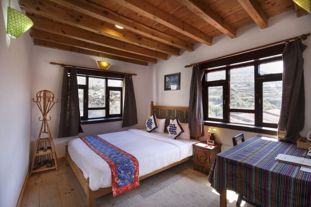
However, in quite a few of the villages that the road to Lo Manthang passes through you can now stay in a number of welcoming family guest houses.
Many of the guest houses in the larger villages along the way to Lo Manthang can provide private rooms, with proper beds, linen, blankets and even electric blankets/hot water bottles for those chilly Mustang nights. You can even have an en suite, private room with western style toilets and warm showers too, although these are usually pretty rudimentary.
But, these basic “creature comforts” do mean that roughing it in Mustang is no longer the default.

The guest houses do vary a bit as they are all independently owned. However, as they tend to be run by Mustang locals whom are invariably friendly and hospitable they are a great way of informally getting to know more about the people of Mustang.
Find out more about Mustang Family Guest Houses
Our Mustang Discovery jeep tour utilises guest houses along the way
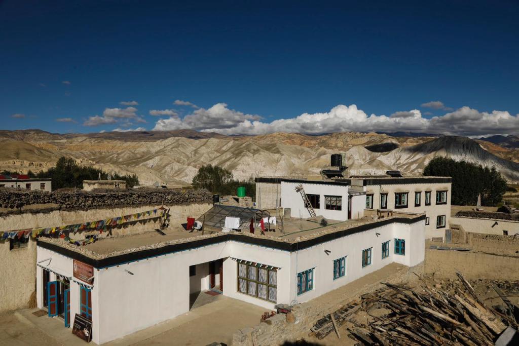
A more recent development has been the creation of a handful of “deluxe” boutique style hotels.
At the time of writing these are limited to those listed below, but in time there will surely be more.
Whilst describing them as “luxury” may not be entirely accurate, these are the highest standard of accommodation that exist in Upper Mustang and certainly if you compare them to the very basic conditions the locals live in, then they are indeed a luxury.
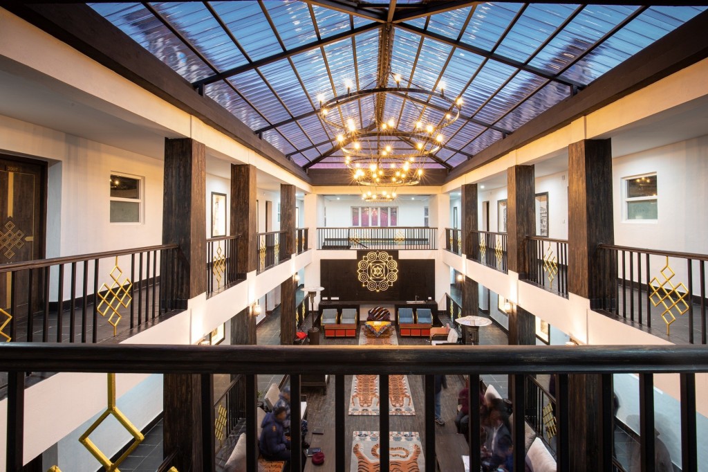
Royal Mustang Resort – Lo Manthang

Presently the highest standard of accommodation to be found in the entire restricted area of Upper Mustang.
Maya’s Heritage Inn – Charang

A tasteful boutique heritage hotel owned and managed by “Princess” Maya, the niece of the last King of Mustang.
Red House Lodge – Kagbeni
The simplest of comfort lodges in the heart of Kagbeni on a narrow cobbled street with real Mustang locals for neighbours.
Lo Mustang Himalayan Resort – Muktinath
A short distance from the famous Muktinath Temple, this relatively new hotel affords a good standard of very comfortable en suite accommodation even though you’re in the high ramparts of the Himalaya.
For a “posh” Toyota Land Cruiser tour of Mustang using the best hotels see MUSTANG IN STYLE
How to Get to Mustang
For the avoidance of doubt we specifically mean “how to get to Lo Manthang” rather than just Upper Mustang as a region.
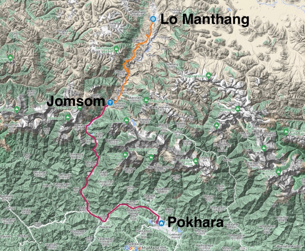
So, the two options we’ll elaborate on are BY ROAD FROM POKHARA to LO MANTHANG and BY AIR/ROAD from JOMSOM TO LO MANTHANG.
Either way, the journey to Lo Manthang begins in Pokhara.

Although there’s always the possibility of a Grand Tour of Nepal overland like our Kathmandu to Lo Manthang tour.
POKHARA TO LO MANTHANG BY ROAD
We’ll divide this overland epic and very adventurous road trip to Lo Manthang from Pokhara into two sections.
The lower section from Pokhara up to Jomsom and then from Jomsom into Upper Mustang and to Lo Manthang, although in actual fact the road extends beyond Lo Manthang to the Kora La, which is the border between Nepal and Tibet. However, at present foreigners cannot cross into Tibet at this border and it remains open for trade purposes only.
It’s fair to say that the overland journey from Pokhara to Lo Manthang could well be one of the world’s greatest road trip adventures dramatically heading up through the Himalayas to then pass between the giant peaks of Dhaulagiri and Annapurna and emerge on the arid Tibetan Plateau.
Indeed Pokhara at a mere altitude of just 2,600 feet (800m) and within the lush and warm sub-tropical zone and Lo Manthang at 12,500 feet (3810m) in a chilly, high mountain desert are in stark contrast to one another. As the road climbs ever higher to Mustang you pass through various and ever changing climactic zones. The culture changes as you gain altitude too.
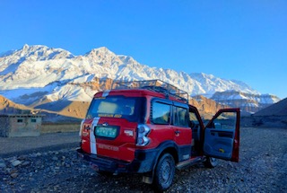
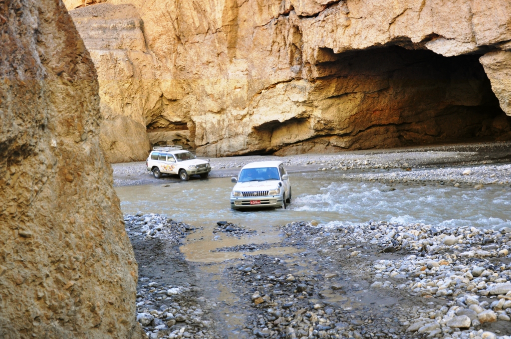
The road itself is sometimes rough jeep track and basically a single lane road. However, many sections (and work is on going) are now metalled. But, the journey is best suited to 4WD vehicles as some sections can be tricky, particularly if nature has had something to say about it.
Pokhara to Jomsom
Following the main highway out of Pokhara to Baglung to then follow a single track road that allows the course of the Kali Gandaki River Valley to Beni. Indeed this valley extends all the way up through the Himalayas and into Upper Mustang itself.
Initially it’s undulating and mostly along side the river up until Galeshowr, where you cross a bridge and start rising to reach Tatopani. Further on the road then leaves the river bank and begins to climb steeply up to Ghasa, although there some dramatic views down to the river now precipitously far below.
Climbing steeply further up from Ghasa towards Kalopani the immense and imposing bulk of Dhaulagiri at 26,795 feet (8167m) comes into full view. Revealed in all its glory and so close you feel like you could almost touch it. Things road wise then seem to level off a bit as the valley becomes broader and soon you also have views of the Nilgiri peaks and the Annapurna massif.

The road then continues to rise, although rather steadily now, passing the village of Marpha before reaching Jomsom from where there are striking views of Nilgiri South Peak.
At this point you have essentially passed through the Himalaya and practically all natural vegetation and trees abruptly ceases to exist, as you are now beyond the monsoon rain shadow and will get your first glimpse into the now barren Kali Gandaki Valley into Upper Mustang.
Whilst this may all sound very straightforward, this road up through the Himalayas and which is essentially following the original Annapurna Circuit trekking route from Tatopani up to Jomsom remains at the mercy of the mountains and the weather. The Himalayas are still growing, so every now and again nature causes landslides as does heavy rain, particularly during (but not limited to) the monsoon season.

With heavy rain huge waterfalls cascade off the mountain sides and these can and do in “hot spots” take parts of the road away with them, or cause mud slide blockages too.
We did say this is an adventurous road trip!
Delays apart, two days should be allowed for the journey from Pokhara to Jomsom and this section of the journey to Lo Manthang is not a good idea during the monsoon months.
Jomsom to Lo Manthang
The road to Lo Manthang initially follows the eastern side of the Kali Gandaki Valley and from Jomsom the village of Kagbeni is soon reached. This is as far as you can go without a special permit. On the outskirts of Kagbeni there’s a police check post, where your Mustang permit will be checked and then you are in the restricted area of Upper Mustang!

The road is mostly of an undulating nature as it skirts alongside the now broad and seemingly level and stony river valley floor.
Reaching Chhukksang (Chusang) as well as the village, it’s the weathered landscape of ochre and brown cliffs that’s quite unique and fascinating.
A short distance beyond Chhukksang the road leaves the eastern side of the valley to head over to the western side and to the village of Chele.

Your attention may be drawn to a number of “sky caves” across the valley. Passing Chele, the road now climbs away from the valley floor, first to the Taklam La at 11,900 feet (3624m) and then higher to the Dajori La at 12,250 feet(3735m).
This is a spectacular viewpoint, particularly if you look back towards whence you came with the peaks of the Annapurna range and Dhaulagiri on display, reaffirming the sensation that you really are in the high lands that lie beyond the “Himalayan wall”. As you descend towards Samar, the familiar colours associated with the Mustang landscape have a noticeable addition: green!

This is due to the number of poplar trees that thrive here, adding all-year-round colour to this otherwise barren and hostile landscape.
There are still several passes to cross on this incredible journey, including the Bhena La at 12,260 feet (3860m), the Syangboche La at 12,230 feet (3850 m), and the Nyi La (4010 m), amongst others. Reaching the ruins of the old settlement of Ghemi, you can see the longest Mani wall in Upper Mustang too.

From here there’s another pass to cross before dropping down to Charang.
From Charang the road then climbs over the “windy” pass and from where you’ll see the fabled “walled city” of Lo Manthang down below.

Whilst in theory you can drive from Jomsom to Lo Manthang in one very long day (perhaps 10+hrs), the questions is “why would you want to?”
Even so, if you were in a hurry to get to Lo Manthang, you still need to think about adequate acclimatisation.
For more on acclimatisation see our About Altitude article.
BY AIR
From low lying Pokhara there are daily flights to the airstrip up at Jomsom which lies at an altitude of 9220 feet (2810m). And of course these flights return from Jomsom to Pokhara. It’s a mere 18 minute flight, but a rather dramatic one as you fly between Dhaulagiri and Annapurna.
Like all mountain flights in Nepal, the Pokhara-Jomsom-Pokhara flights are entirely weather dependent.

Indeed due to the strong anabatic winds that affect the Kali Gandaki Valley, these flights can only operate in the early morning. Flight cancellations due to weather can and do happen relatively frequently, so being delayed in Pokhara or temporarily stranded in Jomsom is always a possibility and adequate contingency provision is a good idea.
Bad weather and clouds during the monsoon season can cause delays of several days.
If you are flying to Jomsom then you would journey onwards to Lo Manthang by road as described in the Jomsom to Lo Manthang section above.
When to go to Mustang
Mustang is arguably the only part of Nepal that can be visited during the monsoon in the summer months. In fact up in Mustang this is usually the warmest time and it’s certainly much milder than the winter months up there.
Whilst the rest of Nepal experiences heavy downpours of rain (about 80% of its total annual rainfall) during the summer monsoon (June-September) the Himalayas form a natural barrier and prevent the monsoon from extending beyond them thus creating a “rain shadow”.
Upper Mustang, which lies to the “other” side of the Himalaya and on the Tibetan Plateau is protected by the Himalaya from the monsoon rains, which is why Upper Mustang is an arid and barren high altitude mountain desert.

Indeed Mustang could be regarded as an “all year round” destination to visit, although there are of course seasonal variations to the climate.
Most visitors to Mustang will be spending most of their time between 3,000m-4,000m.
The general rule with altitude and temperature is the higher you go, the colder it will get. Around 6 C cooler for every 1000m of altitude gain.
The winter months in Mustang are bitterly cold. Even during day time temperatures may not be much above freezing, although in the rarefied atmosphere at these higher altitudes the sun can still be quite strong and make it feel warmer than it actually is. Temperatures at night time during winter usually plummet to well below freezing. However, the reward of enduring colder weather is often crisp, clear mountain views and fewer tourists. The region is also blighted by bitterly cold winds emanating from Central Asia during winter.

Whilst the summer months are the warmest, the caveat for visiting Upper Mustang during the monsoon months is that although the monsoon doesn’t reach Upper Mustang you still have to get up there. So that means travelling up through the monsoon affected parts of Nepal. Consequently the road up to Mustang can be detrimentally affected and flights can be delayed or cancelled. The heavy rains and deluges often cause problems with transportation. Bridges and roads get washed away and planes can’t see to fly.
Over a year Upper Mustang experiences around 25cm-40cm (9.8in-15.7in) rainfall.
The average daily temperature for day time is around 11C.
According to Wikipedia day and night time temperatures range as:
| Month | Day Temperature | Night Temperature |
| December, January, February | 0 to 5 °C 32 to 41 °F | -25 to -20°C-13 to -4 °F |
| March, April, May, June | 16 to 22 °C 61 to 72 °F | -6 to -2°C 21 to 28°F |
| July, August, September | 20 to 33 °C 68 to 73 °F | -3 to 0 °C 27 to 32 °F |
| October, November | 12 to 20 °C 54 to 68 °F | -8 to -4 °C 18 to 25 °F |
We would generally consider the most favoured times to visit Upper Mustang as late March to late May and September to mid-December.
The Upper Mustang Restricted Area Permit
To enter Upper Mustang beyond Kagbeni and thus consequently travel to Lo Manthang or elsewhere in Upper Mustang a “restricted area permit” is required.
You must also be accompanied by a licensed guide.
You cannot obtain the Mustang Permit yourself, only a registered tour operator like Snow Cat Travel can obtain your Mustang permit.
Consequently, if you were thinking of visiting Upper Mustang independently, you may as well forget such thoughts and arrange a Mustang Tour with a registered operator.

The Mustang Permit costs $US 500 per person and allows for up to ten days of travel in Upper Mustang.
If you want to be in Upper Mustang for longer then an additional charge of $ 50 per person, per day would apply.
Upper Mustang permits are issued on a minimum of two persons travelling together basis.
A solo traveller may be issued a permit providing the minimum two person total cost is paid.
In other words a Mustang permit for a solo traveller costs $US 1000 for ten days and an additional $100 per day thereafter.
You will also need an Annapurna Conservation Area Project (ACAP) permit too, which costs $US 20 per person.
To obtain your Upper Mustang permit for you your operator will have to present hard copies of your passport (scans are not accepted) and two passport photo’s by 1000 hrs. to the permit issuing office in Kathmandu.
Consequently Upper Mustang permits cannot be obtained in advance as your original passport must be presented.
The permit office in Kathmandu is open Sunday-Thursday, Friday Mornings, and all day Saturday. The permit office is also closed on Nepali Public holidays.
Therefore as part of your Mustang travel plan you should factor in a couple of nights in Kathmandu first in order that your Upper Mustang Permit can be obtained by your chosen tour operator.
See our full range of tours and treks to both Upper Mustang and Lower Mustang HERE

One thought on “Mustang, Nepal – An Illustrated Travel Guide to the “Roof of the World””
Comments are closed.